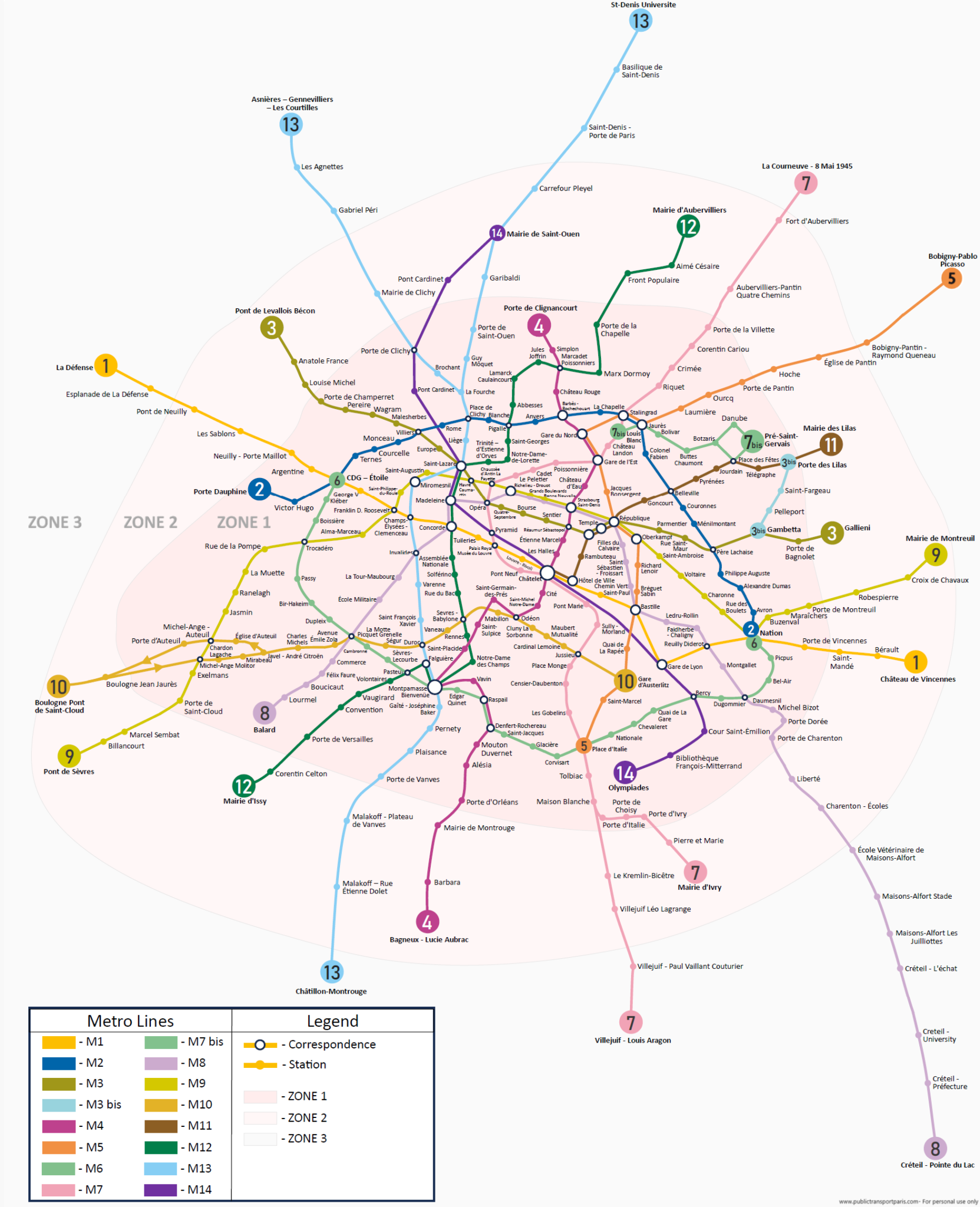
Paris Metro maps
The Paris metro network consisting of 16 lines in different zones. The expansion is under progress to reach the metro rail network to all zones of the Paris Public transport network. Currently the metro reached the first three zones. We are introducing the first paris public transport’s responsive map, where you can interact with the elements of the maps. You will find the detailed maps below for each line.
Metro Line 1
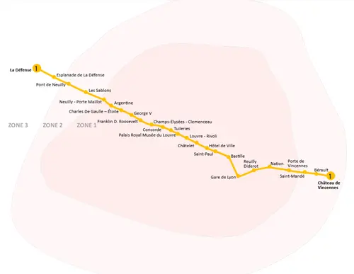
Explore Paris’s first digitally interactive map of Metro Line 1
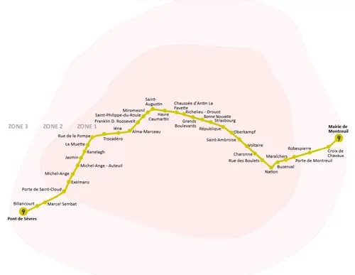
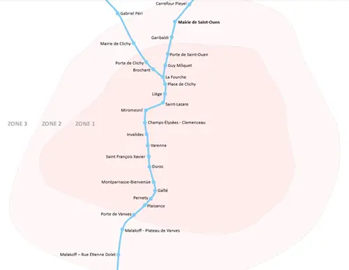
Metro Line 2
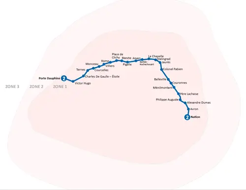
Explore Paris’s first digitally interactive map of Metro Line 2
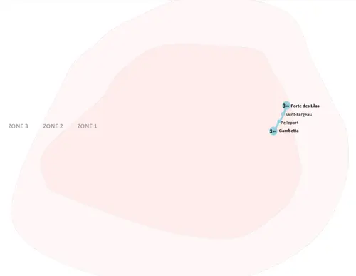
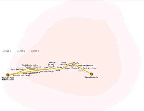
Metro Line 3
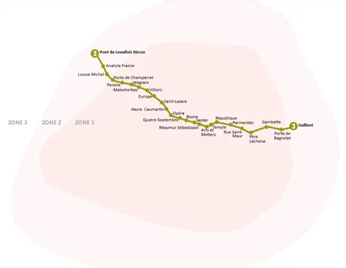
Explore Paris’s first digitally interactive map of Metro Line 3
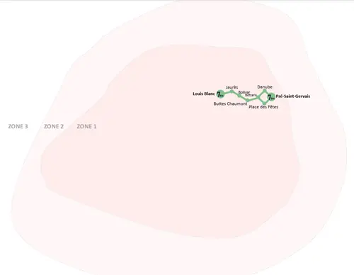
Metro Line 3 bis
Explore Paris’s first digitally interactive map of Metro Line 3bis
Metro Line 4
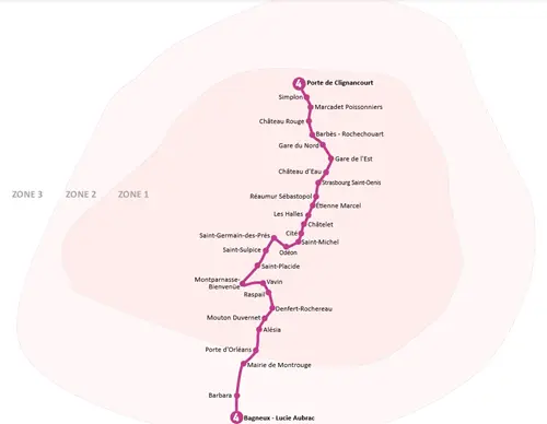
Explore Paris’s first digitally interactive map of Metro Line 4
Metro Line 5

Explore Paris’s first digitally interactive map of Metro Line 5
Metro Line 6
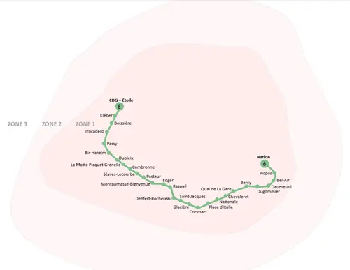
Explore Paris’s first digitally interactive map of Metro Line 6
Metro Line 7
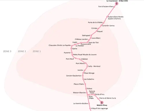
Explore Paris’s first digitally interactive map of Metro Line 7
Metro Line 7bis
Explore Paris’s first digitally interactive map of Metro Line 7bis
Metro Line 8

Explore Paris’s first digitally interactive map of Metro Line 8
Metro Line 9
Explore Paris’s first digitally interactive map of Metro Line 9
Metro Line 10
Explore Paris’s first digitally interactive map of Metro Line 10
Metro Line 11
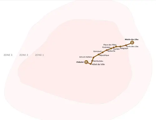
Explore Paris’s first digitally interactive map of Metro Line 11
Metro Line 12
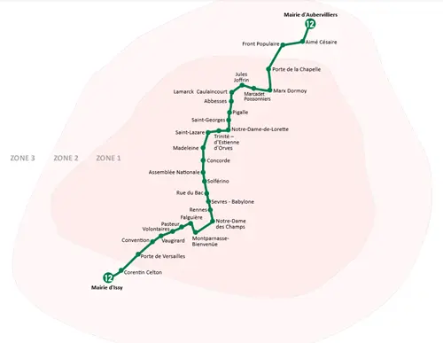
Explore Paris’s first digitally interactive map of Metro Line 12
Metro Line 13
Explore Paris’s first digitally interactive map of Metro Line 13
Metro Line 14

Explore Paris’s first digitally interactive map of Metro Line 14